
For agents and brokers
Sell the land, not a blurry aerial.
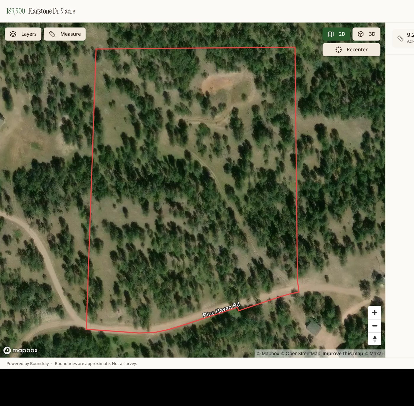
Epiloft turns a parcel number into an interactive property map: approximate parcel boundaries, GIS-reported acreage, overlays, and a 3D flythrough, in about the time it takes to write the listing description. No drone, no GIS software, no Photoshop.
Why it closes gaps
Buyers stop asking 'where does it end?'
Approximate parcel boundaries appear on the map, photos, and 3D view. GIS-reported acreage, plus approximate frontage and distances, one tap away. For planning and estimating. Not a survey.
Built for land, not houses
Parcel owners, USFS land, FEMA flood, contours and soils are toggles, not a separate research project.
Lives on your site
Copy an embed snippet into your listing page, or send a clean standalone link for socials and email.
Add real aerials when you want them
Request a shoot from a local Epiloft pilot and the finished photos with approximate parcel boundaries drop into the same project. See how it works.
Five steps to a listing map
- Search the address or drop a pin.
- Click the parcel. The approximate parcel boundary and GIS-reported acreage load from county GIS.
- Turn on the overlays that matter to this buyer.
- Label access, water, building sites, and features.
- Publish, then paste the embed code into your listing.
Approximate parcel boundaries come from public county GIS and are for marketing and orientation only. They are not a survey, and every published page says so. Exports carry a built-in approximation notice, so your marketing stays compliant.
Agent pricing
Map one listing, or all of them. Sign up free, pay only when you map a listing.
Explore
Founding agent pricing$4.99/month
or $40/month, billed annually
Lock in this rate for as long as your subscription stays active. Prices will rise as the platform grows; founding agents keep theirs.
The roaming map: search anywhere, find yourself on it, pull parcel and ownership records.
- Search and roam anywhere
- Live location on the map
- Parcel and owner lookups
- Flood, contour and terrain layers
Map project
$10one-time, per listing
One listing, published. Approximate parcel boundaries, your photos, listing data, a link and an embed.
- One property page, live 12 months
- Approximate parcel boundaries and overlays
- Planning measurements. Not a survey.
- Your photos, auto-pinned by GPS
- Share link and embed code
- Renews for $10
Agent Mapper
Founding agent pricing$49/month
or $41/month, billed annually
Lock in this rate for as long as your subscription stays active. Prices will rise as the platform grows; founding agents keep theirs.
Every listing, mapped. Explore is included, and your pages stay live while you do.
- Unlimited map projects
- Explore map included
- Share links and embeds on every listing
- Listing data pulled from your URL
Free accounts get the map inside each project, including owner names on the parcel layer. Explore adds the roaming map and lookup tools, and is included with Agent Mapper.
Whole brokerage? See team plans.