
The questions that show up before the machine does
You're guessing yards on a lot with 20 feet of fall.
Draw the work area and calculate cut, fill and volumes on your own site. Know your number before you bid. For planning and estimating. Not a survey.
You won't know if the plan fits until the excavator's there.
Foundation Fit puts the proposed building on the captured terrain, so you can study pad elevation, daylight, excavation and fill before mobilizing. For internal planning and estimating. Not a survey.
The developer wants to know how many lots fit on 40 acres by Friday.
Conceptual Site Planning studies buildable areas, access and lot yield against the terrain. Concept only, not for recording.
Earthwork software costs $4,000 a year and assumes a GIS degree.
Pick the property, get a mission plan, fly it and upload. Cloud processing and the planning tools live in one workflow.
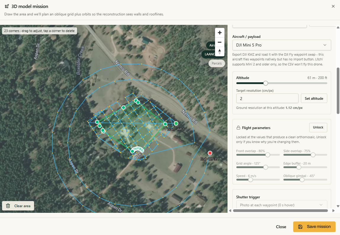
One captured site, the tools you actually use
Every measured output is for internal planning and estimating. Not a survey.
Cut/fill and volumes
Circle a pad, pile or excavation and know your number before you bid.
Foundation Fit
Set a proposed home on captured terrain and estimate excavation, fill and finish grade.
Contours and slope
See how the ground moves without trying to read it through trees or a flat aerial.
Terrain and runoff
Trace likely drainage paths and ponding on the available bare-earth surface.
Conceptual Site Planning
Study buildable areas, access and lot yield. Concept only, not for recording.
Wall planning
Plan wall locations and budget. Requires engineered design.
Takeoff PDFs for your job file
Save selected measurements, site shots, assumptions and scale status together.
Model import
Bring models from RealityCapture, Metashape or DJI Terra into the same planning workspace.
Cut/fill without the enterprise contract.
Big platforms put cut/fill behind custom-quoted tiers. 3D Studio is $149/mo billed annually, $179 month-to-month.
One clear subscription for the planning workspace. Cloud processing is purchased only when you run it.
Planning-grade on regular drone GPS. Tighter with ground control. Never called a survey.
Ordinary drone GPS can give you useful relative measurements for planning, estimates and comparing options. Add ground control when the job needs a tighter real-world fit, then have the appropriate licensed professional confirm anything used for construction or boundary decisions.
Learn how to capture a stronger model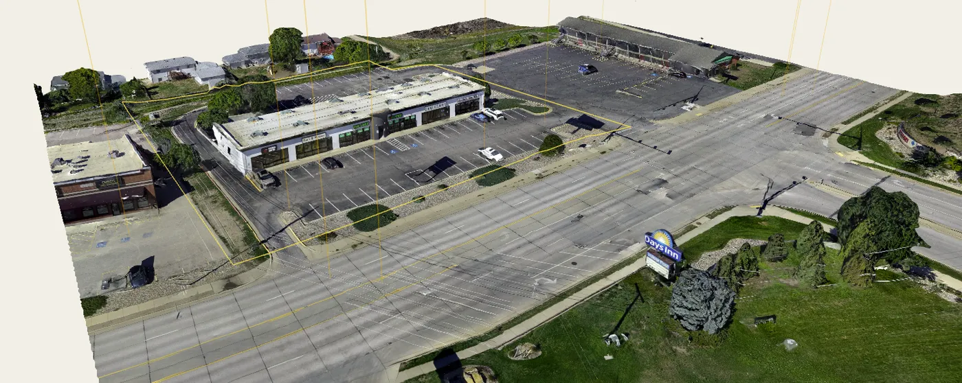
Built by a working general contractor, real estate broker, and licensed drone pilot.
3D Studio pricing
Start with a real site during the 14-day trial.
Epiloft 3D Studio
Founding pricing$149/month, billed annually
Lock in this rate for as long as your subscription stays active. Prices will rise as the platform grows; founding members keep theirs.
Your captured terrain, earthwork tools, concept planning and job-file reports in one place.
- Cloud photogrammetry and 3D model tools
- Cut/fill, volumes and takeoffs for planning and estimating
- Foundation Fit, contours, slope, terrain and runoff
- Conceptual Site Planning and model import
- For internal planning and estimating. Not a survey.
- 500 GB storage
Cloud processing is billed separately with prepaid credits.
Need an occasional model while using Photo Pro? Buy one model run for $30. Compare plans.