Property lot lines on drone photos and 360s
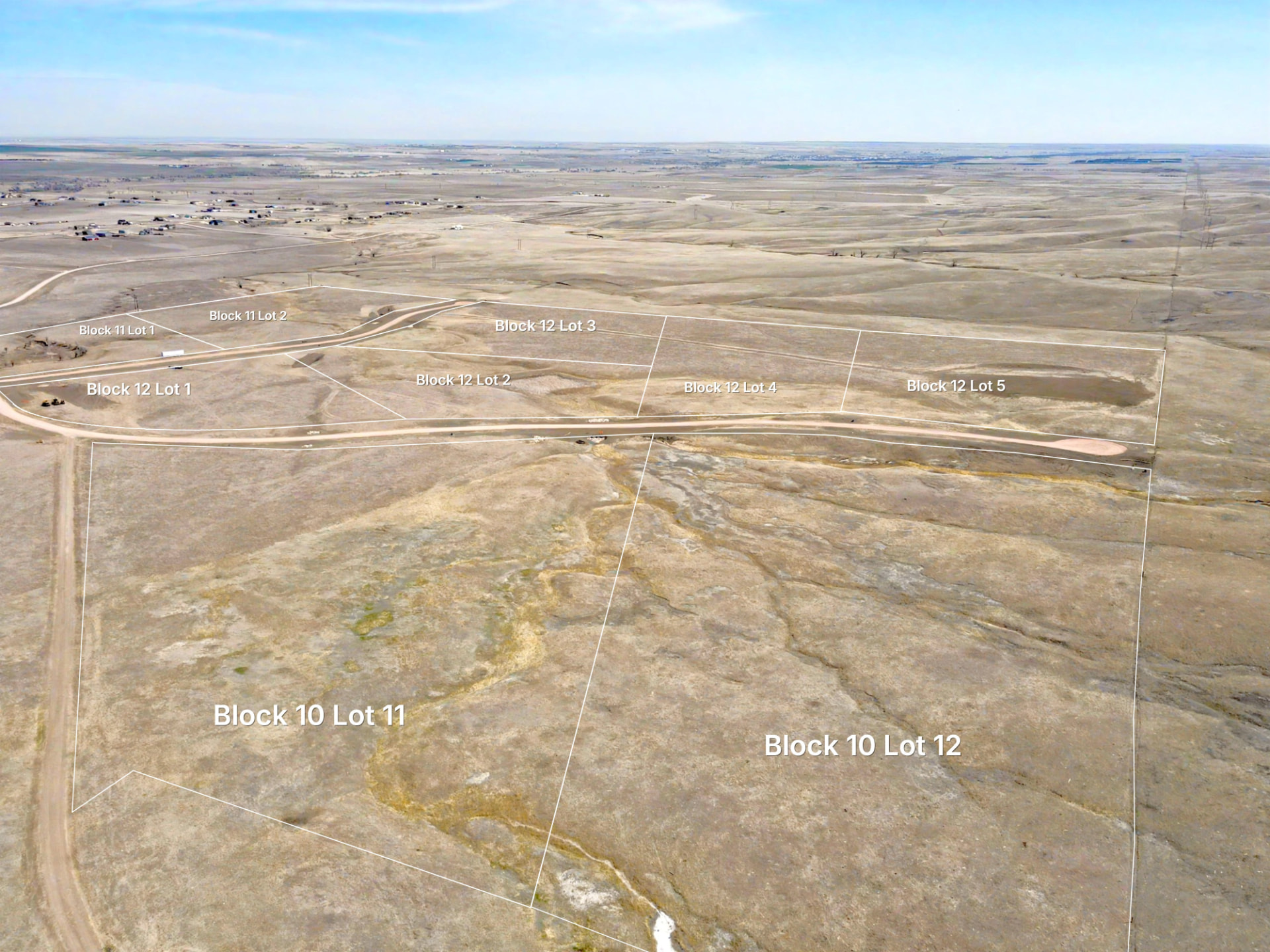
Show buyers which land they are looking at, with approximate parcel boundaries drawn into drone photos and 360 panoramas.
From parcel data to the photo
Epiloft uses project boundaries and the photo’s camera information to suggest lots in the frame. Project the relevant lots, then review the placement against the land you photographed.
Keep each lot recognizable
Add lot numbers and labels, choose a line style and use a translucent fill or dim the surroundings. Each photo stays connected to the lots it shows.
Review before you deliver
Camera alignment can need adjustment, especially with ordinary drone GPS. Align the projected lines to visible reference points and check every result. The boundary disclaimer travels with delivered images.
Questions about lot lines
- Are these survey-grade property lines?
- Lot lines are approximate, from public parcel data, not a survey. Use a licensed land surveyor to establish a legal boundary.
- Can I show lot lines in a 360 photo?
- Yes. Epiloft projects approximate boundaries into 360 panoramas as well as still photos, with optional lot fills and labels.
- Does every photo support automatic projection?
- Projection needs usable camera position and orientation information. Review the suggested placement; missing metadata or inaccurate GPS can require manual alignment.
Try it on a real property
14 days free, no card. Up to 5 projects, 1,500 photos in total and 25 GB of storage. Share pages are preview-only and no 3D processing or AI Enhance credits are included.